A collection of hikes on Vancouver Island, BC
I have found Vancouver Island to be the perfect place to explore the outdoors and find new areas to hike. From the vast range of mountains to the small, hidden lakes and rivers, I haven't yet been disappointed by one of these hikes and I don't believe I ever could be.
The Island is a great place to hike for people of all ages and fitness levels, whether you're looking for a day hike or a multi day trek, day or night. Full of provincial parks, beautiful lakes, and thousands of acres of forests to explore, there really is no end to the wonders you will find.
I have always enjoyed going out hiking with family and friends from as far back as I can remember. Whether it be short day hikes or 5 day long outings, I always enjoy being outside with my camera in hand. At the bottom of the page there is an interactive map I have put together of the hikes I have done recently, ranging from a 1/2 to 10 hours, 100m to 1500m inclines and stunning views at the mountain top to delving into a local cave.
Personally, my favourite type of hike is to the top of a mountain to capture the stunning view or following a creek or river to find a waterfall or lake. Luckily for me, Vancouver Island is filled with stunning views from the mountaintops, and thousands of lakes and waterfalls. My current favourite hike is the long but stunning Cape Scott Provincial Park, followed closely in second and third by Lone Cone Mountain and Mount Landale. I've always heard the quote "It's not the destination, but the journey," In my experience, hiking on Vancouver Island is the best of both worlds.
Click on the name or picture for a gallery of images from that hike!
Quick Links To Each Page: Mystic Beach, Mount Tzouhalem, Mount Prevost, Robertson River Falls, Botanical Beach, Skutz Falls, Bear Creek Caves, Hill 60, Mount Landale/Lomas Lake, Maple Mountain, Blue Lagoon, Bald Mountain, Christopher Rock, Coon Creek, Blue Grouse Mine, Mesachie Mountain, Mount Benson, Ammonite Falls, Cottonwood Creek, Lantzville Foothills, Carmanah Walbran, Shaw Creek, Mount Good, Kinsol Trestle, Goldstream Trestle.,
Sombrio Beach, Stocking Lake Trail, Cathedral Grove
Sombrio Beach, Stocking Lake Trail, Cathedral Grove
Mystic Beach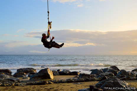
Mystic Beach is a short hike, but that doesn't mean it's not a gorgeous hike. Only a quick 2 kilometer walk through the woods on a root covered trail, filled with boardwalks and bridges will bring you to the ocean at Mystic Beach. The walk is just about as nice as the destination, but the beach takes the win on this one, as soon as you reach the sand you are greeted by a long trailing shoreline complete with tall waterfalls, large undercover areas in the sea wall and even a rope swing. Located along the Westcoast Trail near China Beach, park in the lot at China Beach and follow the signs to the Mystic Beach Trail. See More...
Mount Prevost
You can hike Mount Prevost in two ways, you can start at the bottom on Prevost Rd or you can drive 20 minutes along that same road, and finish the hike with 5 minutes of walking. If you choose the longer way it will take about an hour and a half to the summit. The trail to the top is a popular downhill mountain biking route, so you have to keep an eye out when you're hiking up and down, but the view from the top is well worth it. From the top you can see all of Duncan, parts of Victoria and many mountains surrounding the valley all in one beautiful landscape. Day or night the view from the top is a stunning sight. See More...
Botanical Beach
Although Botanical Beach isn't really much of a hike, being only a short kilometer from the parking lot, it's still a gorgeous sight to see. Going to Botanical is all about going at the right time, My friends and I managed to get there during sunset when the tide was low enough to walk around the rocks and explore before the tide came in, and I managed to take some of my favourite photos so far this year. This beach is full of long, deep tide pools, sea stacks full of life, and plenty of barnacle covered rocks. As well as a few sandy-ish beaches to explore. The longer you spend here wandering the rocky shores, the more you'll begin to like it, that is if you haven't already had your See More...
Bear Creek Caves
The Bear Creek Caves are hidden very well in the mountains up from Skutz Falls, but once found, the caves provide a rewarding challenge. Not only finding the caves, but diving into them is a challenge. The trek to the caves is half spent walking up what seems to be a dried up creek bed and a quad trail which then connects to an old logging road. The logging road provides stunning view down the bank where it has been clearcut almost all the way to the creek, as well as a clear view of the surrounding mountains. Once you reach the caves, which are well hidden along the side of the trail, only being marked by a bit of flagging, a small entrance is on the hillside. This cave starts out small and gets even smaller before opening up to reveal a large cavern complete with stalactites, bats and See More...
Mount Landale/Lomas Lake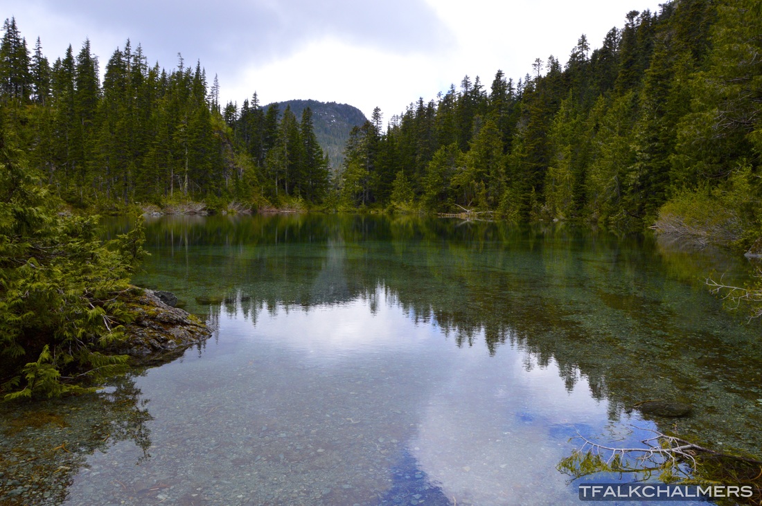
For a total distance of 25km from start to finish and 9 and a 1/2 hours, hiking Mount Landale was my longest day hike, yet. The hike begins 2km onto the logging roads past Youbou on the Cottonwood M/L road, after 5k walking alongside Cottonwood Creek, passing small waterfalls, potholes on the creekside and carved out sections of rock by the flowing water, you will have to cross a downed tree where the bridge used to be. Soon after the crossing, the trail parts from the creek and continues on upward, passing through dense forests full of large trees, alongside small creeks and waterfalls, through switchbacks and along rock faces with a view of the valley below. After about 12k total, at an elevation of 1100m, the trail comes to a small lake known as Lomas Lake, with a beautiful green shade surrounded by See More...
Bald Mountain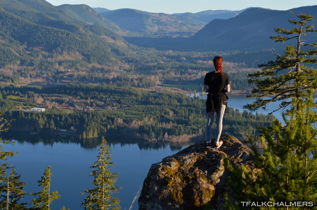
With many routes to choose from, Bald Mountain can take 30 minutes or 3 hours. Starting just passed Marble Bay in between Youbou and Lake Cowichan, the hike follows a marked trail up the mountain. Continue through switchbacks and light forests until you reach a junction that splits right, to the smaller plateau that overlooks Marble Bay or left, up the the top of Bald Mountain with a view of both Marble Bay but also the bay behind on the Youbou side of the lake. The top of Bald Mountain isn't the true end of the hike, a sign at the top marks the end of the maintained trail, but locals know that beyond that sign there are many more viewpoints and a few more trails that snake around the remaining section of the mountain. See More...
Coon Creek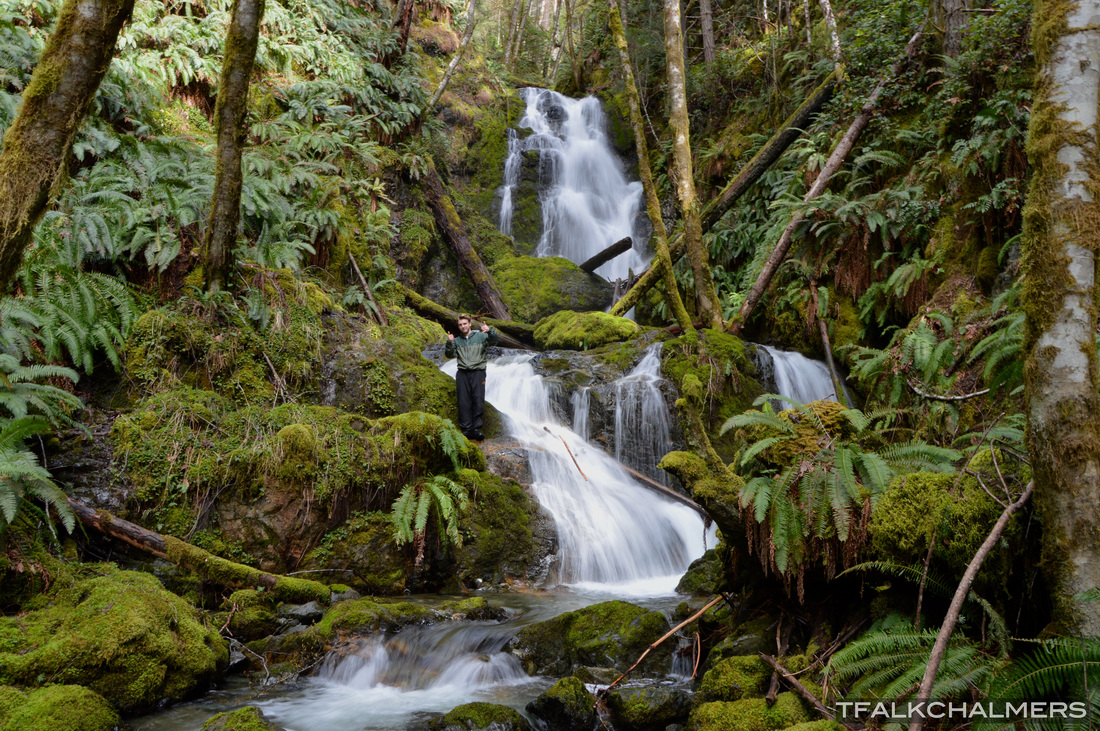
Coon Creek is yet another hike that is more of an exploration. Between scaling waterfalls and using bushes to climb up the mountainside, there is no easy way up this creek. As I found when I went up, this should have been named Coon Falls instead because the entire journey up the creek is waterfall after waterfall. On the way up there are tall 70ft cascading falls, short stretches of bald rock with water rushing across and everything in between. There isn't much of a clear view from the top, but through the trees the elevation gain is very noticeable. Coon Creek can be accessed right off Youbou Rd, across from the old Bar and Grill See More...
Mesachie Mountain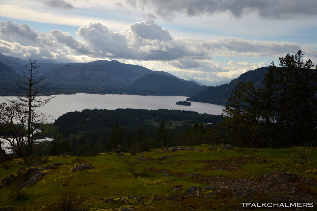
Driving from Lake Cowichan to Mesachie Lake, this mountain looks like a tough climb. In reality, making the top only takes about 45 minutes to an hour. Directly overlooking Mesachie Lake, the top of this mountain provides quite the view of both the lake and the town, as well as down Cowichan Lake towards Honeymoon Bay and as far as Youbou. The beginning of this hike is next to the entrance to the Cowichan Lake Research Station at the end of Fisher Rd. See More...
Ammonite Falls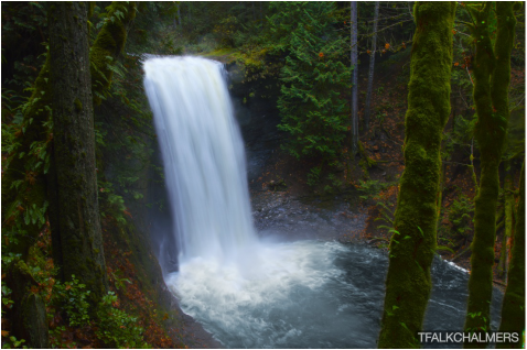
I had heard about Ammonite Falls for many years before I actually went for myself. A short 2.5km walk through the forest on the bottom of Mount Benson brings you to a section of Benson Creek which in the rainy season produces a stunning waterfall flowing off the 20m+ drop into the underlying pool known as Ammonite Falls. In the dry season the waterfall continues to flow but not nearly as much as the rest of the year, if you want to walk along the bottom of the falls or climb the surrounding hills, this is the time. The majority of the walk to the falls is downhill and a rather easy hike, aside from the last section, no longer than 50m that is steep enough to need the ropes lying around to continue down to the bottom. The trailhead is at the end of Jameson Rd but the parking lot is another 50m down the road. See More...
Lantzville Foothills
A series of gravel logging roads and twisting deer trails make up the Lantzville Foothills. This area is not so appropriately named hills, but more like small mountains. One of the hills on the Benson side with an elevation of 320m above sea level, provides a view of Nanaimo, Mount Benson and the forest surrounding. The hill on the ocean side with a slightly taller elevation of 330m, has a view of North Nanaimo, Nanoose and the Winchelsea Islands as well as a clear view across to Vancouver. Both main hills can be climbed in under a couple hours for a short day hike, located on Harwood Rd, near the end of Aulds Rd. See More...
Shaw Creek
Along the logging road, Shaw Creek is a ways past Youbou. A short half kilometer walk along the creekside trail brings you to a stunning pool of water streaming calmly through large rock faces, smoothed by the flowing water which then creates a giant, colour filled pool that overflows down the rocks into the next pool. The pools are immediately outstanding with bright yellows in the shallow water and dark greens in the deep, complete with light blues reflecting off the rock walls and even a few purple/red rocks on the beaches. The surrounding area is filled with moss covered rocks, logs and trees perfect for a rope swing and hammocks. This hidden treasure is the perfect "secret spot" to go relax for the afternoon or camp for a night. See More...
Kinsol Trestle
Although the Historic Kinsol Trestle isn't really a hike, as it's only a 1km walk along a wide flat trail from the parking lot near Shawnigan Lake, it's quite a stunning sight. Part of the Trans Canada Trail the Kinsol Trestle continues the 100km trail stretching all the way from Lake Cowichan. As soon as you reach the trestle, from either side, you notice just how tall it really is, and really take in the sight. From either end of the trestle you can see the other end as it curves over the river, and from the back side you can stand on one of the 4 platforms and look down to the river or gaze upon the curve of the trestle as it stretches along. On the far side of the trestle there is a viewing area where you can see the trestle form end to end and there are picnic tables down below perfect for a snack by See More...
Goldstream Trestle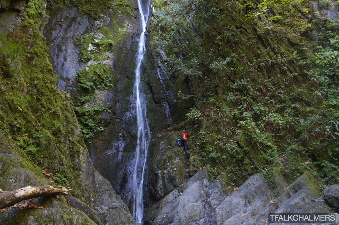
Located across the highway from Goldstream Park, just North of Victoria, Goldstream Trestle and Niagara Falls are both sights I'm glad I've seen and something I'm sure to come back to. Starting off in Goldstream Park, following the trail to the North and immediately under the highway will bring you to the bed of Niagara Creek. Flowing seasonally, walking through the tunnel was dry when I came to this hike but other times of the year it doesn't seem to be. Shortly after the tunnel there are two ways to go, the first is to follow the creek bed for roughly 100m until reaching the stunning 47.5m cascading waterfall, flowing with icy cold water even in Summer. The sides of the creek being too steep, continuing to the trestle means a quick 180 is in See More...
Stocking Lake Trail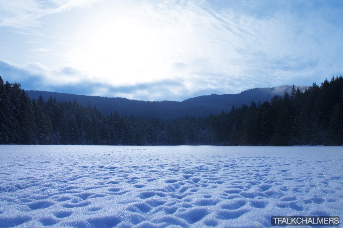
The Stocking Lake Trail intersects with the Heart Lake Trail, the complete loop is an 11.5k round trip trek. From the trailhead up the Stocking Lake side is only about six kilometres and is primarily a well maintained road used to upkeep the towns water supply. This makes for an easy walk up the 300m+ incline, aside from a few snow and icy patches to navigate through. As you start to reach the lake, the snow gets deeper. The time of year I hiked in there was about 2ft of snow in some sections making for an interesting hike without snow shoes. Coming over the ridge and into the viewpoint of the lake is a stunning sight, especially in winter when the entire lake is frozen over and the sun causes all the snow to shine and twinkle in the light. After passing around, or over Stocking Lake, the walk to Heart See More...
Elk Falls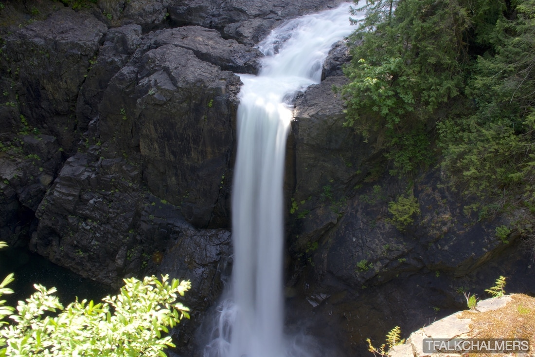
Elk Falls Provincial Park consists of about 12k of various trails, a cool suspension bridge and a stunning 25m waterfall. Located off the Gold River Highway, on the Northwest side of Campbell River, Elk Falls can be hiked a number of ways. The more scenic route can be accessed across from the Quinsam Campsite for the start of a 12km route along the side of the river filled with boardwalks and a few hills, next to and then over the John Hart generating station and looping at the waterfall then back along the same path. The more direct route can be accessed from the parking lot a little further down the Gold River Highway, providing a short walk through the woods and straight to the See More...
Lone Cone Mountain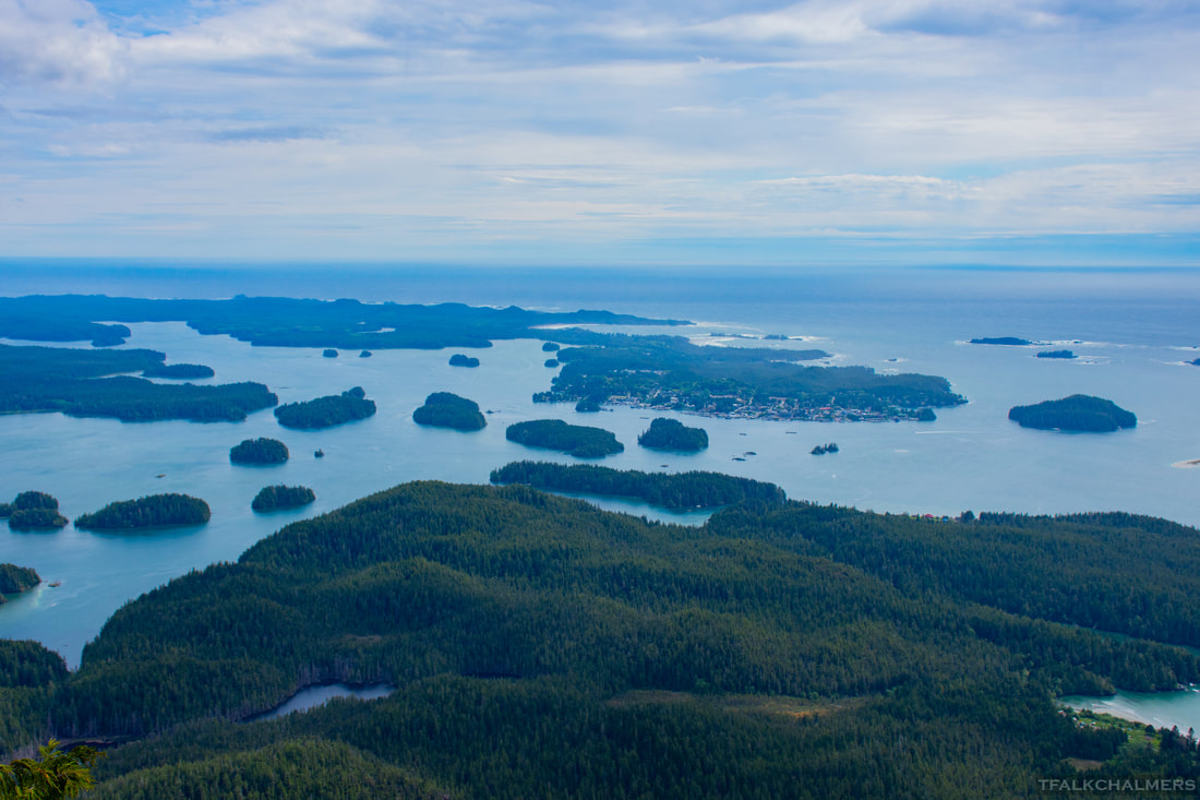
Lone Cone Mountain is a 7 kilometre round trip hike located on Meares Island just North of Tofino. The adventure begins when you leave the docks of Tofino and embark on a short but scenic water taxi to Meares Island where you are dropped off on the island to start your trek. A short walk up the road is the technical beginning of the hike, and from here the 3.5 kilometre and 730m incline begins. In the first kilometre and a half, the trail turns and winds through the relatively flat forest or occasional swamp and then slowly starts to increase in elevation. Over the next two kilometres the elevation starts to climb and along the way there are sections with fantastic views, lookout points and a somewhat challenging trail if you count having to hoist yourself over (and under) fallen trees, stumps, collapsed bridges and See More...
Roberts Roost
Roberts Roost is a five and a half kilometre round trip hike through Morrell Sanctuary and up the side of Mount Benson. The trail starts off through Morrell on an easy, wide and very open trail until crossing under the power lines where the trail narrows and becomes more of a hike than a walk. Although short, the trail does become steep as it ascends the side of Mount Benson with some sections requiring the use of a rope to assist in the climb. While following the trail, there are many scenic areas to stop and take in until finally reaching the roost where the real view is. From the roost there is a clear view of downtown and South Nanaimo, as well as a clear shot all the way down to Ladysmith, Crofton and Chemainus. On a clear day Vancouver is also visible and the ferries are very clear to watch on most of their route. See More...
Nymph Falls
Nymph Falls Nature Park is a small area located West of Courtenay along Forbidden Plateau Road with many trails to navigate for a complete circle route, or a short 600 meter walk from parking lot to river. When nearing the river, the water can be heard flowing through and crashing down over rocks before making the final turn on the trail and seeing the water cascading over neatly carved channels and flowing across smooth rock faces. The lower trail comes out to a perfect swimming hole, full of potholes, small underwater caves and little waterfalls to shower beneath if the water isn't too cold. Exploring about the river brings neat views and interesting caverns carved out by the water over the years, in some cases multiple potholes connecting See More...
|
Mount Tzouhalem
Mount Tzouhalem can take 30 minutes to reach the top, or 3 hours, depending what side you start the hike on. But no matter which way you come from, the view at the top is stunning. From the iconic cross at the top you can see the entire Cowichan Bay area on the one side, as far as Highway 18, and Quamichan Lake on the other. The hike to the top from the church isn't long but it sure is steep. Parking next to the church beside Island Farms on Tzouhalem Rd, the hike starts at the yellow gate and is a wide trail all the way to the top. See More...
Robertson River Falls
Robertson River Falls is a hidden gem that not many know about. On the way out to Port Renfrew on Pacific Marine Road, one of the logging roads on the left side leads to the falls. Following this logging road for about 1km, left uphill onto the next branch of the road then another kilometer until a slight deviation to the left you will find this massive cascading waterfall right below your feet. Looking down on this waterfall is breathtaking as you take in just how tall it really is. During the wet season getting across and to the bottom of the falls is more than a challenge, the water rushes so fast crossing is dangerous and climbing down the side is even worse. Fortunately in See More...
Skutz Falls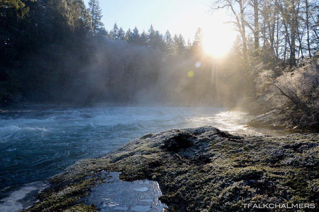
With the many trails to choose from Skutz Falls can be an hour long walk in the woods or a 7-8 hour hike, depending on the route. From the many times I have done these trails, I know them all like the back of my hand. The horseshoe loop is the main trail at Skutz, but you can also continue along the river from the horseshoe to Trestle 66 and loop back for a total of 10 kilometers. Along the riverside there are many side channels and streams running in and out of the river, small islands and sandbars as well as tall cliffs that line the banks of the river. In late fall/early winter this section of river is home to thousands of spawning salmon that can be seen swimming and jumping up the river or the salmon ladders in the upper section. Located at the end See More...
Hill 60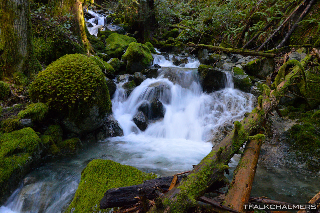
Hill 60 isn't a hike for the inexperienced. I started this hike by navigating up the very slippery Stanley Creek or scaling the mountain beside it, then branching off the creek up the steep mountainside until you reach logging roads which you follow to the top. The view from the first clearcut gives an unobstructed view of the entire town of Lake Cowichan, a clear view down the lake just outside Youbou and a straight shot of Honeymoon Bay in the distance (Mesachie Lake is behind a mountain). I would say this is the best aerial view you can get of Lake Cowichan without taking to the air. As you continue up the twisting logging roads from the clearcut on the front of the mountain you're brought to a view of the many mountain ranges behind Hill 60 before the road loops back to the See More...
Maple Mountain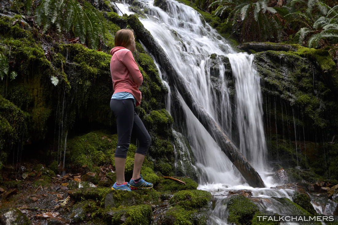
Located just outside of Maple Bay, this hike is complete with 4 or 5 different trails of varying difficulty and length. For those familiar with the trails I decided to take blue one way and yellow back. The blue trail is filled with many small creeks and streams, bridges and boardwalks as it continues up and down the side of the mountain. Just past the junction of the blue and yellow trails there is a creek that cascades down the side of the mountain and continues under the cut log that is made into a bridge that provides a great view of the entire waterfall. Along the yellow trail there are countless views of the ocean and Saltspring Island close by, as well as the tip of Penelakut Island off in the distance. See More...
Blue Lagoon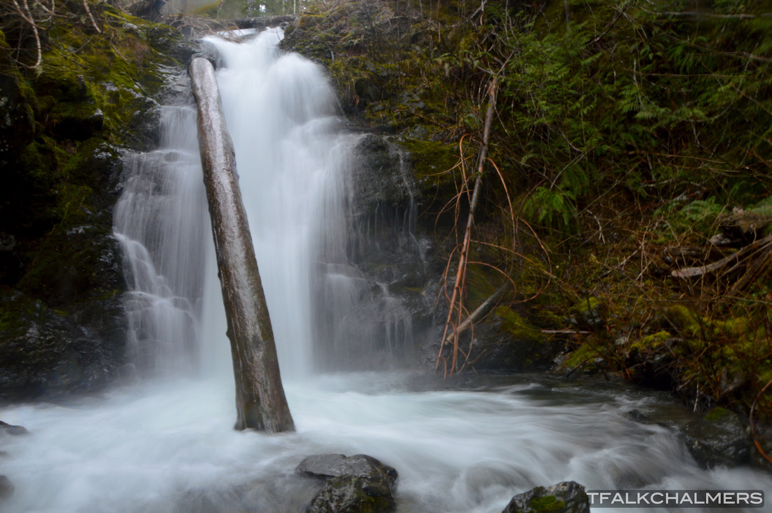
One of the Cowichan Valley's hidden areas, the Blue Lagoon is almost a local secret. Located along Gordon River Rd, Blue Lagoon is only a short walk from the road and a zipline ride away. To cross the river and reach the lagoon you have to sit on a wooden swing, and pull yourself across using the pulley system, but don't pull too fast as the rope will become snagged in the pulley leaving you stranded over the river (believe me, it's happened.) Soon after crossing the river, the lagoon, waterfall and another swing are all right there. During Winter, crossing on the swing is a daunting task as the water level is much higher and much faster. In summer, walking under the swing would be just as easy as riding it across, as well as jumping off the nearby See More...
Christopher Rock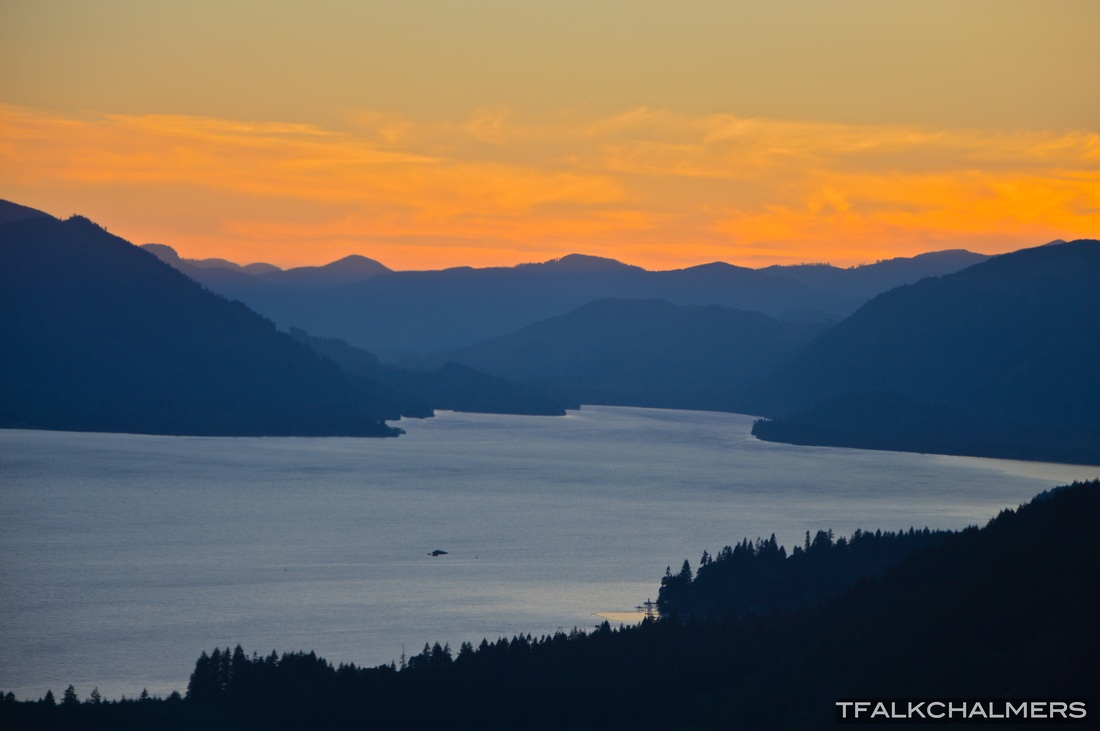
From the countless times I have done this hike, I have got my time down to under 20 minutes from the trailhead to the top. Christopher rock is a short hike to the top, but it's a steep hike. The hike is a combination of switchbacks, steep inclines and borderline rock climbs but it's not hard overall. Christopher Rock isn't nearly the top of the mountain, but it's the most prominent lookout point, second to Eric's Bluff which is only a few minutes further up the mountain. Upon reaching Christopher Rock you're greeted by a clear 180 degree view of Cowichan Lake and a bird's eye view of Youbou and the surrounding area. This hike starts about 50m past the water tower above the Youbou Hall. See More...
Blue Grouse Mine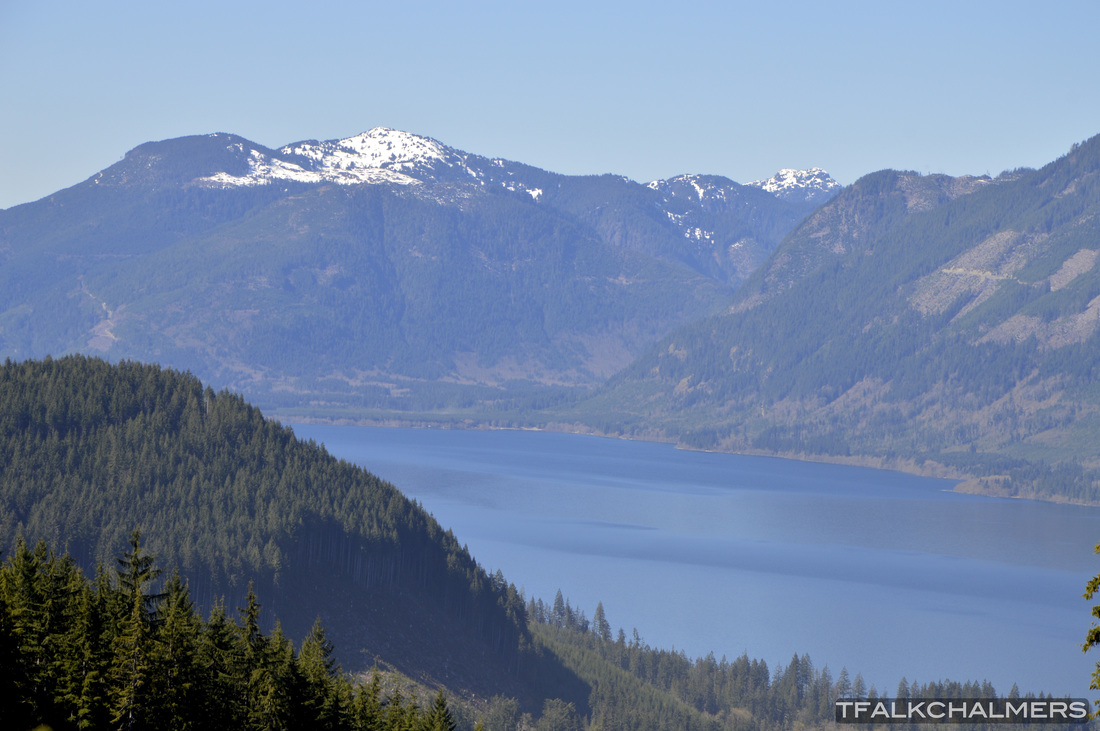
Finding the Blue Grouse Mine is another outing that I would call exploring rather than hiking. Although this does follow a logging road for half of it, this 7 kilometer hike is full of bushwhacking and staying off the beaten path. While I never actually found the mine by following the online coordinates, I did find a stunning, unobstructed view of the entire town of Youbou from across the Cowichan Lake. Somewhere near Gordon Bay is the hidden mine and I hope to find it next time I go looking. See More...
Mount Benson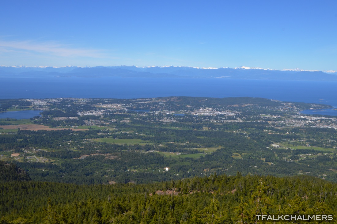
Words can't properly describe the view from the top of Mount Benson, good thing I've got pictures to share. At the top of this 1006m tall mountain is an outstanding view of all of Nanaimo, as well as Nanoose to the North, Ladysmith to the South, Vancouver in the distance and as far as Mount Baker, WA, 170km away. Standing at the summit you can turn 360 degrees and have an unobstructed view, ocean in the front, mountain ranges in the back. The top can be accessed by multiple routes, there are 3 main trails to the top which all have varying difficulties. Two trails on the front are shorter but are also more of an incline. The one on the back is longer but not as steep. Personally I chose the shorter but steeper route which brought me through many viewpoints overlooking Nanaimo along the way to the top and totaled about 8k from Witchcraft Lake to the summit. See More...
Cottonwood Creek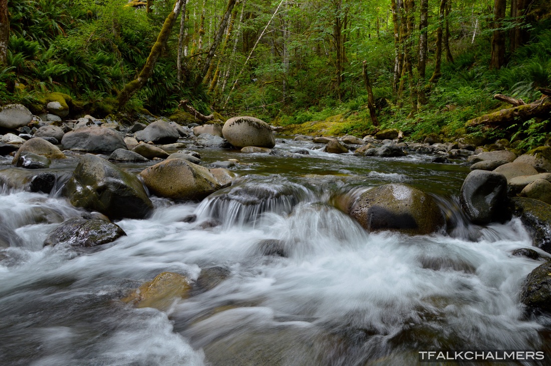
Two kilometers past Youbou, Cottonwood Creek is under the first bridge on the logging road. Each side of the creek has a logging road leading to different places. The road on the far side follows the creek for 5k along a slight incline until the road ends due to a collapsed bridge, replaced by a single log to walk across. Along the way, the creek is complete with many small waterfalls, potholes of all sizes and deep pools carved out by the high water levels in Winter. Foregoing the easy logging road and walking the creekside is a challenge due to the slippery rocks and carved out riverbanks but it's well worth it to see all the smooth potholes and shapes which the creek has created. Past the log bridge, the road continues up towards the summit of Mount Landale and Lomas Lake, although getting to either requires a bit of bushwhacking off the road. See More...
Carmanah Walbran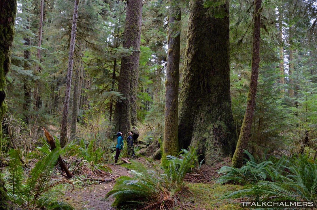
Carmanah Walbran Provincial Park is the hike that's worth every second of the bumpy, windy, pothole filled road that it takes to get to it. Minutes from the parking lot on the first stretch of trail you are greeted by large trees, creeks and moss covered forest floor with a boardwalk fit for a hiker, and by that I mean it's quite old and not much easier than walking the forest beside it. Shortly into the hike there will be a junction, right, leading to one of the largest trees I've ever seen named "Heaven Tree", or left, to the Three Sisters and Paradise Pool. Continuing right along the trail will take you through broken boardwalks, uprooted trees and past many large trees. These trees don't even compare See More...
Mount Good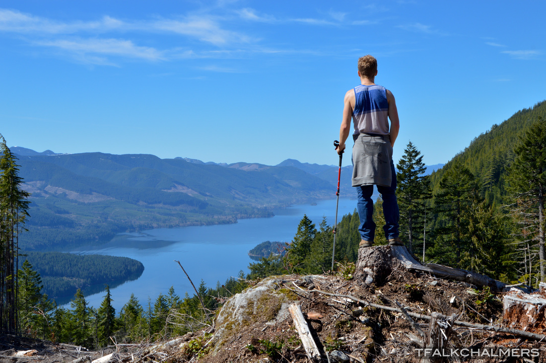
I usually classify my outings as either hiking, which I justify by following a trail or a known path, or exploring, making my own path or bushwhacking through. This one is undoubtedly exploring. While there is no actual path up to Mount Good aside from the logging roads on the backside, I managed to find my way up by following a small creek just outside Youbou, then branching off and continuing up the steep mountainside which turned into scaling a rock face on more than one occasion. This exploration was filled with unparalleled views from each bluff down the lake with a clear view of Youbou and as far as Caycuse. Continuing up the mountain past the logging roads and the clearcut areas there is a steep cliff which we decided to climb to get the best view of the surrounding area. Reaching the top, we were See More...
Heather Mountain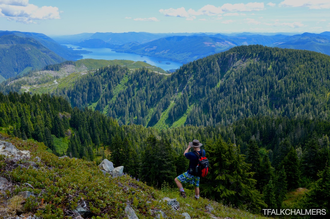
Hiking up to the summit of Heather Mountain is a 22km round trip trek, but with the distance brings the best view of Cowichan Lake I've ever seen. Within the first 3 kilometres hiking up the logging roads you are greeted by a completely unobstructed view of almost the entire Cowichan Lake behind you that gets better and better as you continue to gain elevation. Further along the trail where the logging road turns into more of a quad trail you have a view of Heather Campsite and Kissinger Lake as well as the valley heading out towards Nitinat. Soon after this, the trail follows through switchback after switchback until the road and quad trail completely end with a fantastic view of the See More...
Sombrio Beach/Waterfall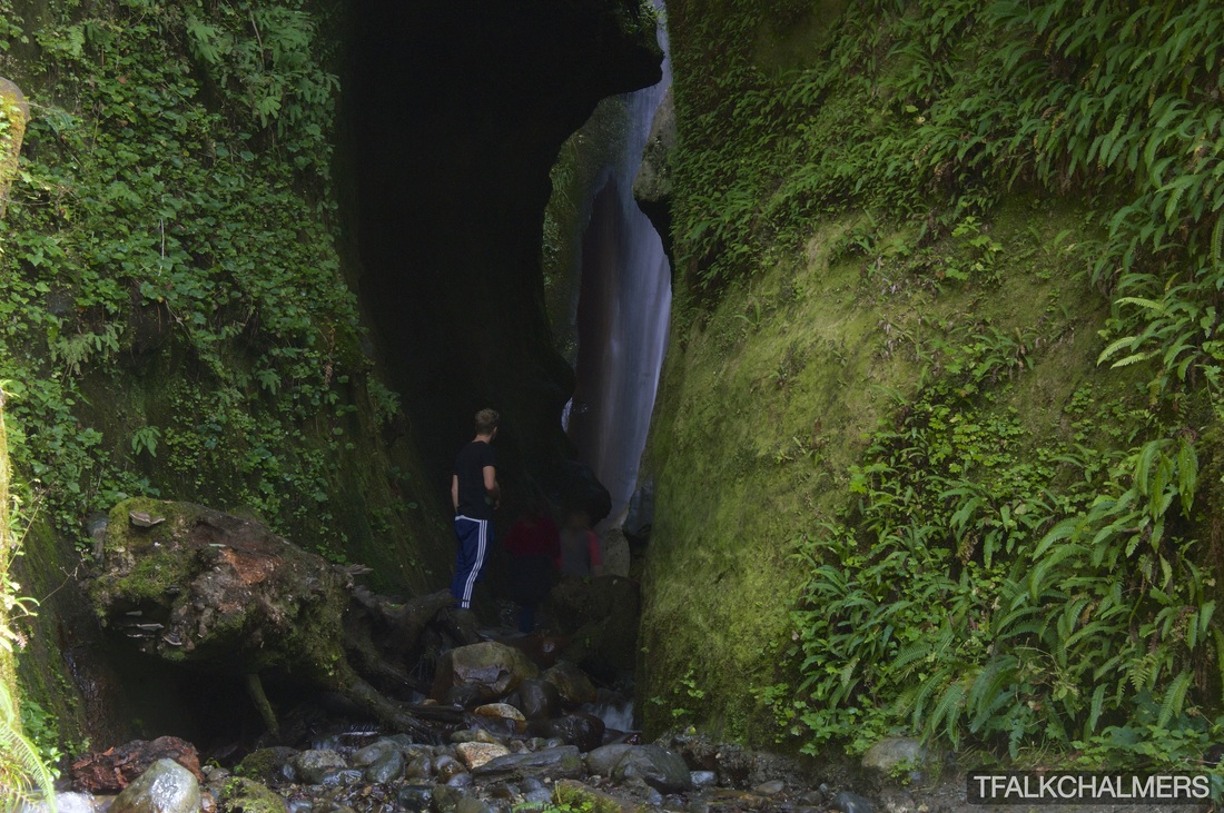
Sombrio Beach is one of the more well known spots on the Island. Popular for surfing as well as camping Sombrio Beach is similar and very close to Mystic Beach, found along West Coast Road on the way to Port Renfrew from Victoria. As well known as this beach is, there are still some secrets to share, from waterfalls to caves the beach is full of surprises and stunning sights to see. A short walk down from the parking lot through the moss covered trees thriving in the moist environment brings you to the wide open beach. To the right the beach stretches far until it curves around a bend, and to the left a short walk along smooth rounded rocks, life filled tide-pools and sleek black sand until you reach the mouth of the creek flowing into the ocean. Following this creek a mere hundred feet and navigating the wet creekside will bring See More...
Cathedral Grove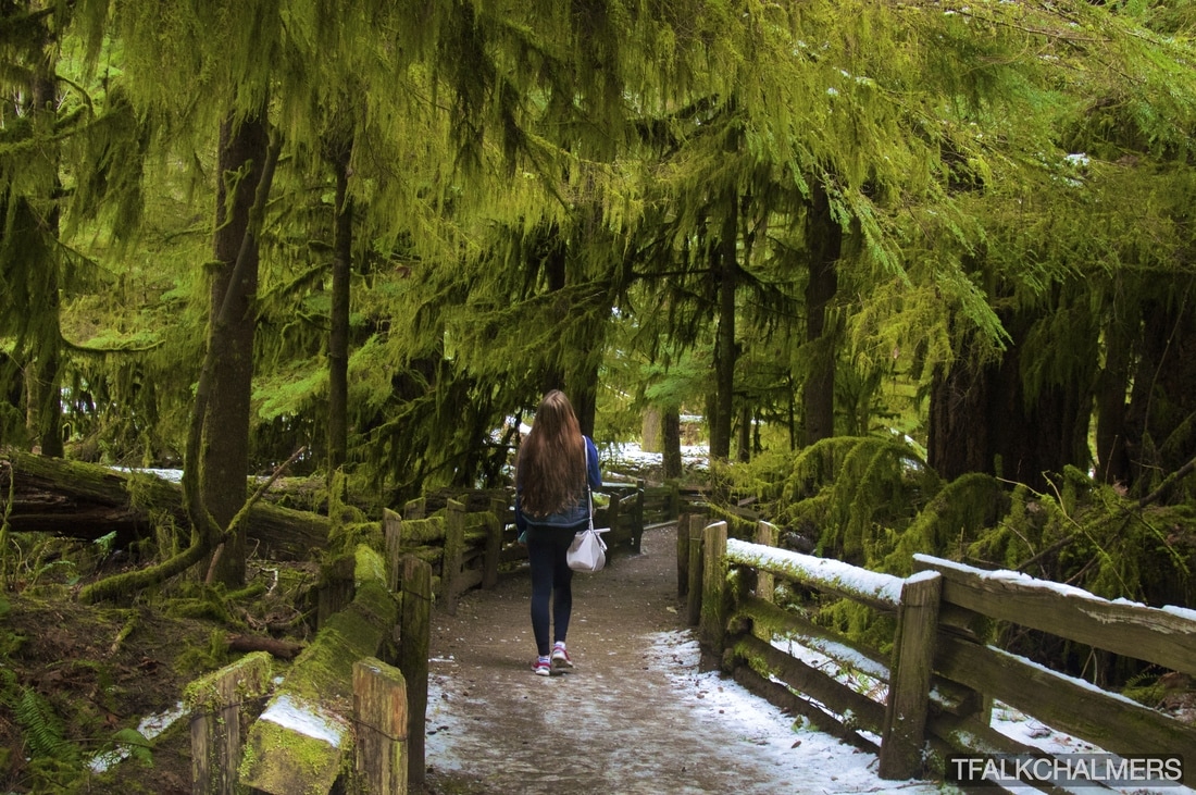
Cathedral Grove is a small loop of trails on either side of the highway in MacMillan Provincial Park, beside Cameron Lake. Although the trails are short and take less than an hour to walk around at a leisurely pace, they are full of perfect photo opportunities. Huge trees, small animals and intersecting pathways to stroll through are abundant in Cathedral Grove, some trees being more than 800 years old, 75m and 9m in circumference. Walking through all the trails takes you past the tall trees, through the lush moss growing in the branches above the path, over massive roots and many places to stop and take photos with the trees or lake. See More...
Cape Scott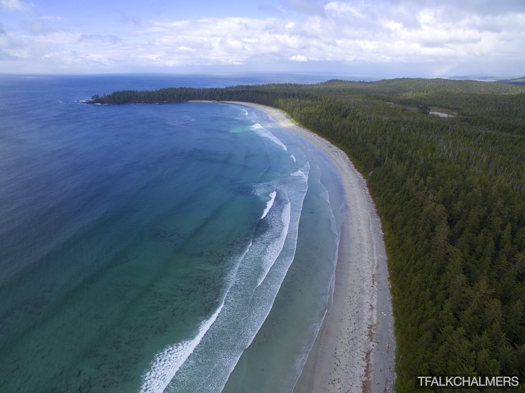
Cape Scott Provincial park is one of my absolute favourite hiking destinations on Vancouver Island. From San Josef Bay all the way to Nels Bight and the Cape itself, all the beaches are stunning and the trails full of life. Located at the most Northwestern tip of Vancouver Island, this park is a bit of a drive for most but well worth it once you get there. Being part of the North Coast Trail the park has been gaining popularity and for good reason, each beach is filled with fine silver sand, long stretches of flat beach and long rolling waves pushing onto the shore line. The first and my personal favourite beach is actually the closest to the trailhead, San Josef Bay. Only a short 2.4km walk from the trailhead along a smoothed gravel pathway through twisting and See More...
Tofino Bomber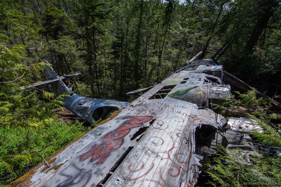
The Casno Bomber is a very well known hike on Vancouver Island and especially popular with tourists in the Tofino area. The beginning of the trail starts on the side of the main highway between Tofino Airport and the town of Tofino and immediately leads into the forest where the first sight is an abandoned building covered, both inside and outside, with colourful graffiti that really stands out against the trees.
After the building, the trail twists and turns through the bush until opening up to a maze of paths through the swampland. Any trail taken will lead the the same end location and they do meet up and cross paths throughout the route, but the real challenge is picking the least muddy path. Continuing through any of the paths there are plenty of downed trees, stumps, See More... Medicine Bowls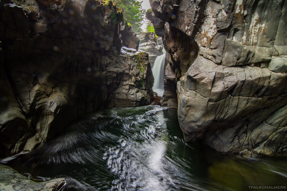
The Medicine Bowls are somewhat of a secret location, located West of Courtenay, mainly locals are aware the area exists. Without a 4x4 vehicle, the trail begins on a bumpy, pothole filled, gravel road that leads 1 kilometre into the forest. With a 4x4 vehicle, the road can be easily navigated to a clearing at the end and then the river is a short walk down the trail. The trail ends abruptly and you are met with fantastic smoothly carved out channels and bowls in the rock below that the water cascades over and through creating many small waterfalls and pools. Further up the river from the trail there are many more small waterfalls and pools as the river travels through the forest. Downstream from the trail there is a secondary path that can be taken to a large swimming area beneath a waterfall, complete See More...
|
All routes and locations are tracked using gps to the best of my ability and should not be relied on for the purpose of navigation, routes are simply a guideline.